Ecological corridor network
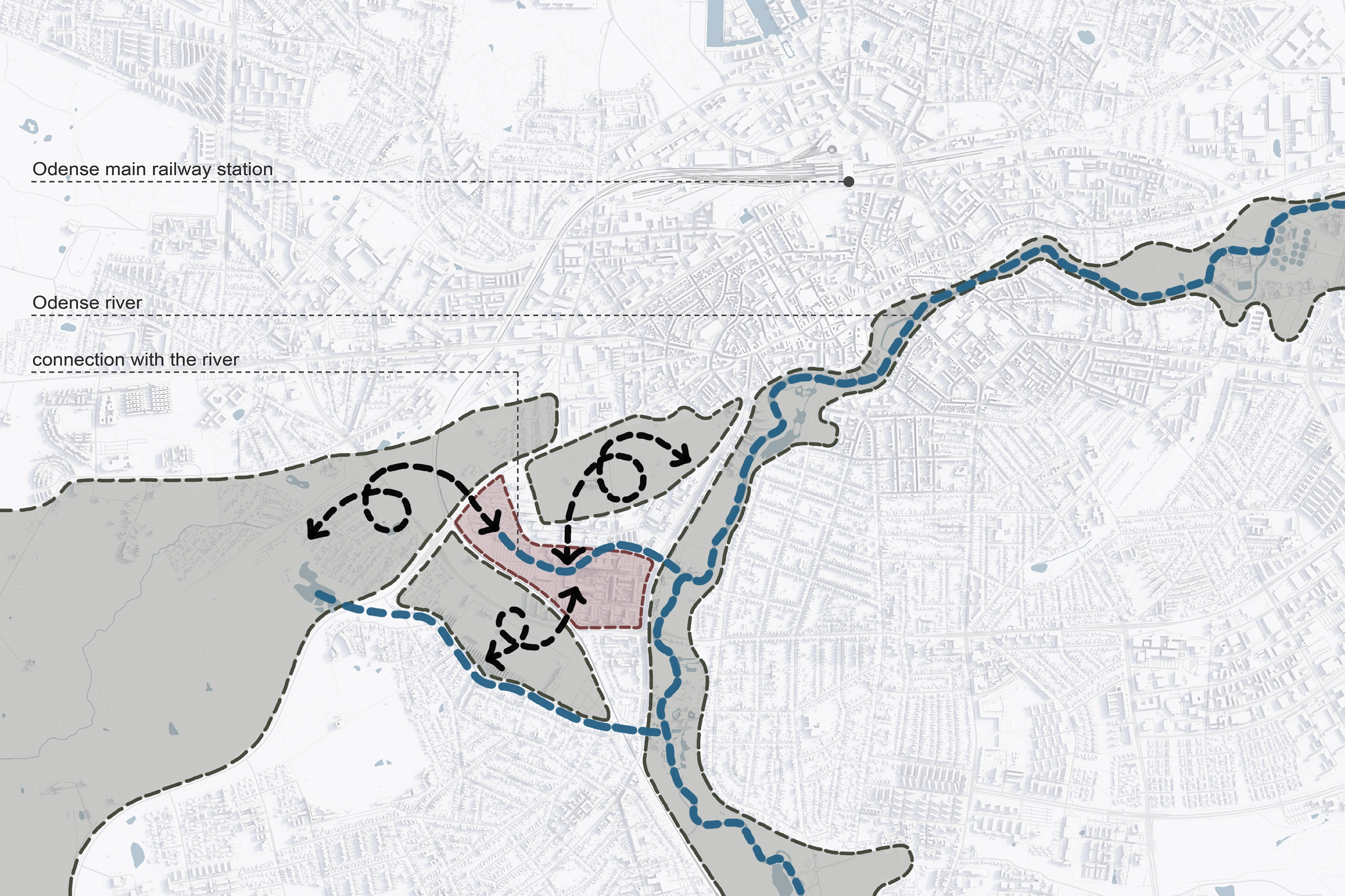
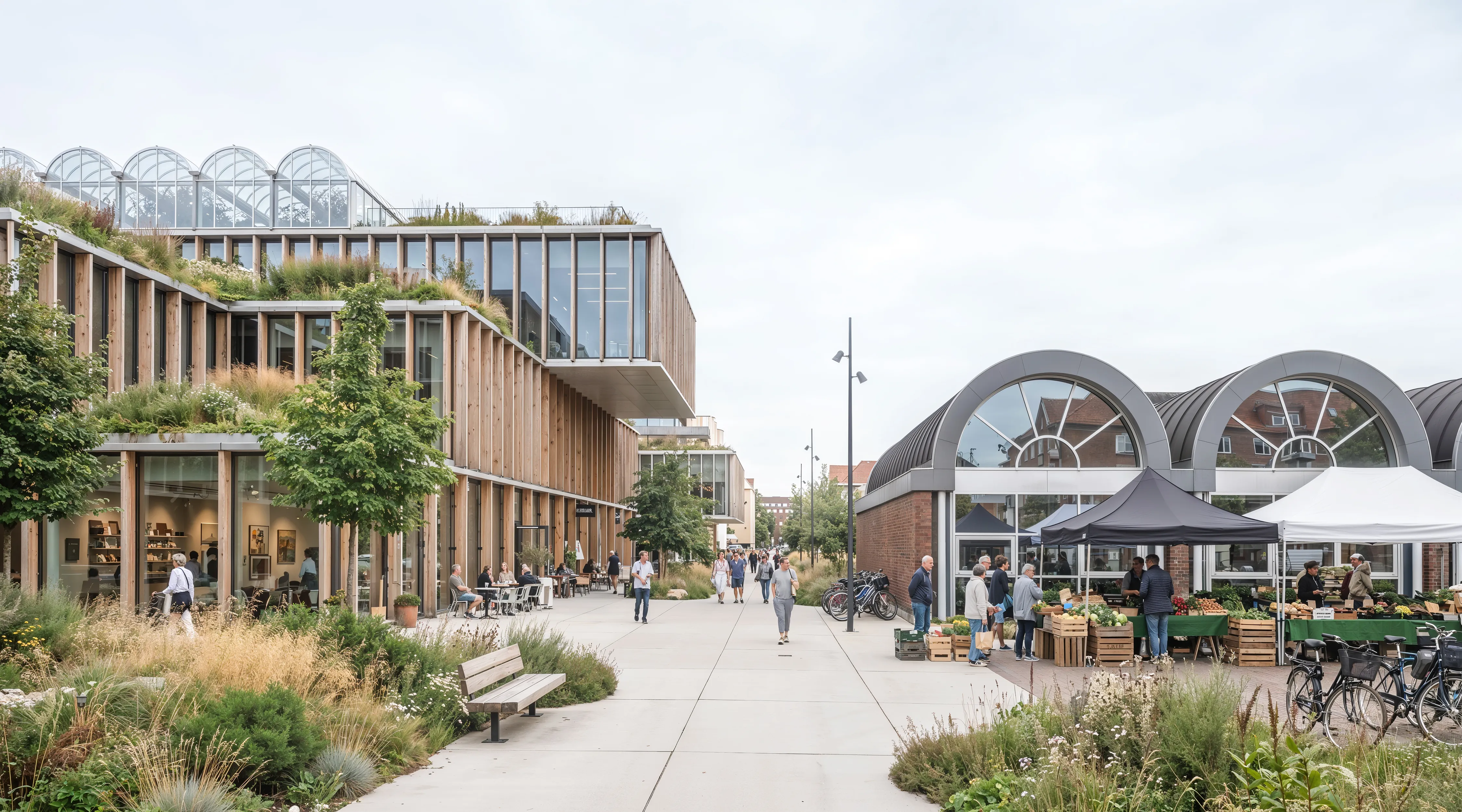
Landscape development and the creation of a green zone establish ecological corridors connecting the area with the river and reservoir, the zoo, the cemetery, and the golf course.
ODENSEED combines Odense and “seed” as a process - an origin point for a new urban ecosystem. The former hospital site is re-imagined not as a development, but as a living infrastructure where water, soil, vegetation, and architecture interact, evolve, and regenerate over time.
ODENSEED combines Odense and “seed” as a process - an origin point for a new urban ecosystem. The former hospital site is re-imagined not as a development, but as a living infrastructure where water, soil, vegetation, and architecture interact, evolve, and regenerate over time.
Space as a Health-Generating System
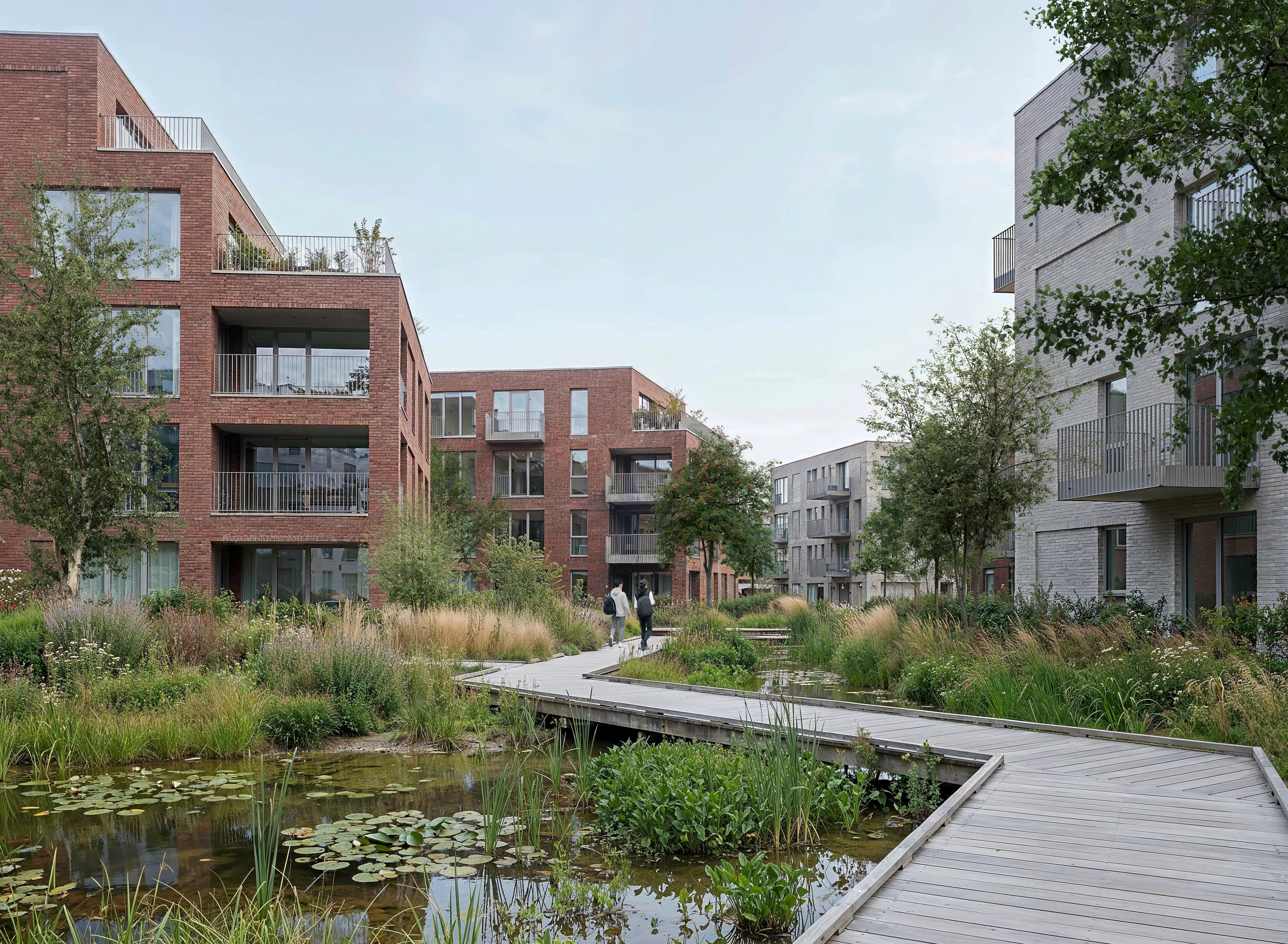
Nature is embedded as an active force in everyday life, influencing physical and mental well-being. Based on Biotopic Urbanism, natural systems define urban structure rather than decorate it. Planning logic emerges from ecological processes: integrated water cycles, permeable environments, minimized hard surfaces, and three-dimensional landscapes spanning ground, facades, and roofs. The result is not a “green district,” but a functioning urban biome.
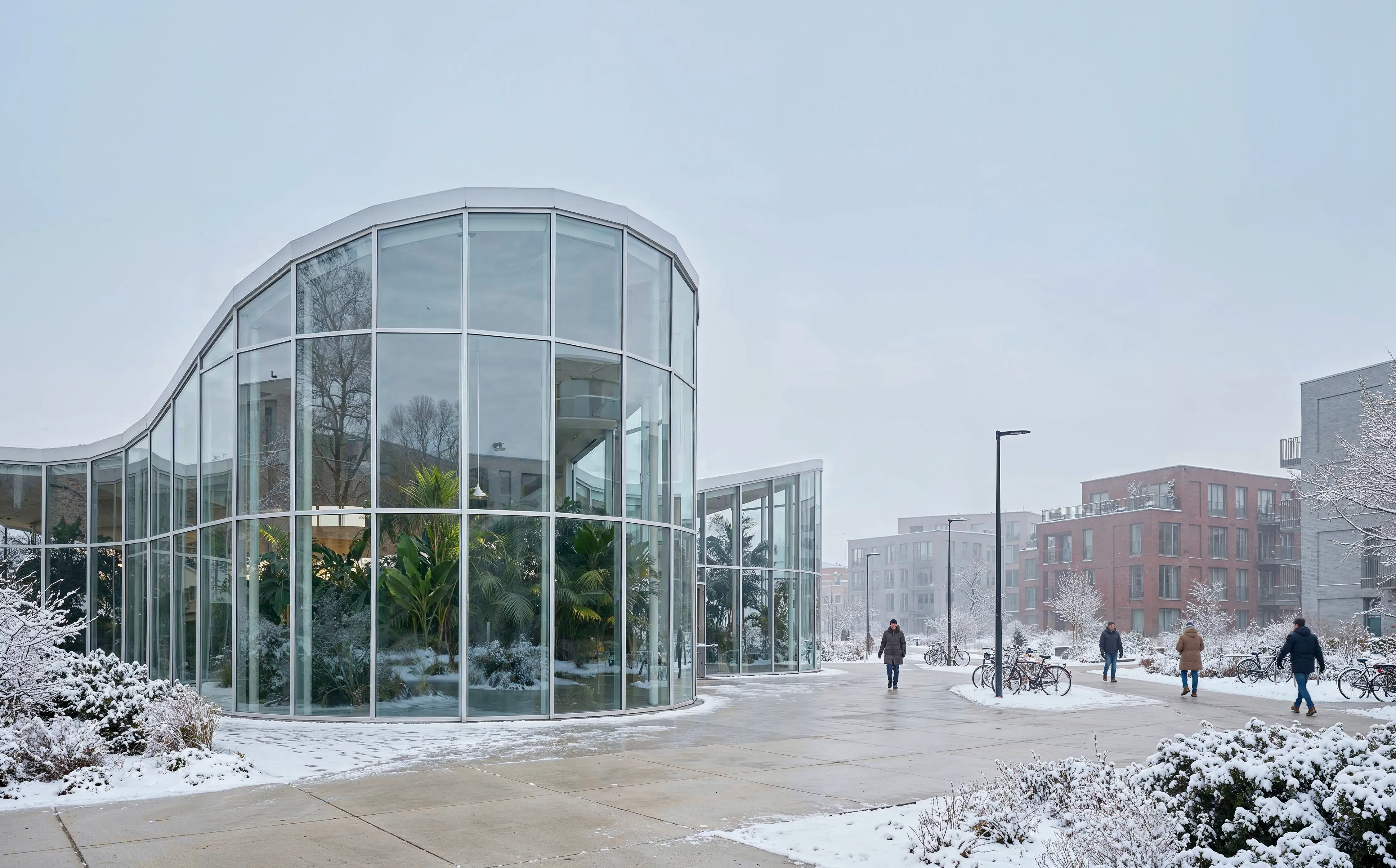
Programs are designed to reinforce the ecosystem. Housing is mid-rise with courtyard ecology. A central hub supports social and environmental interaction. Linear blue-green parks follow water flows, while a creative cluster fosters innovation and sustainable technologies.
Daily life is shaped by health-oriented design: walkable networks, limited car access, and strong cycling infrastructure. Food production is embedded through edible landscapes and urban agriculture. Social life emerges around shared gardens, water spaces, and open interaction zones. Architecture encourages movement through visible stairs and integrated pathways.
The project creates a dynamic system rather than a fixed outcome - restoring water cycles, enhancing biodiversity, reducing environmental impact, and transforming a closed site into an open, connected urban environment that supports community and well-being.
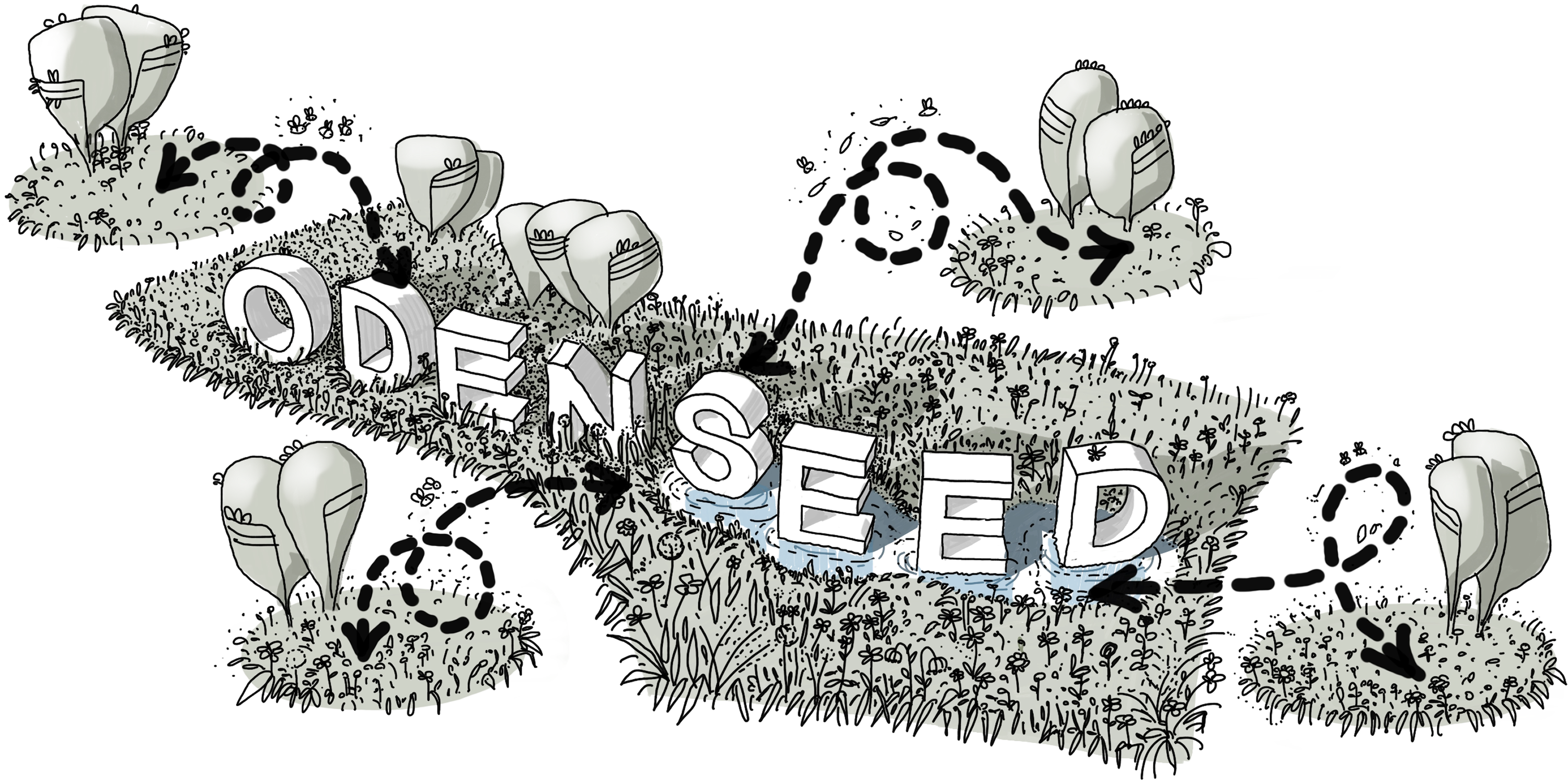
The project is organized through three interrelated layers. Blue Network treats water as core infrastructure - capturing, filtering, and reusing rainwater while shaping public spaces, supporting biodiversity, and moderating micro climate. Green Framework establishes continuous ecological and movement corridors, prioritizing pedestrians and cyclists while connecting habitats and social spaces. Building Layer integrates architecture into the landscape through terraces, cascades, and mixed-use programs, forming a vertical extension of the terrain.
Landscape development and the creation of a green zone establish ecological corridors connecting the area with the river and reservoir, the zoo, the cemetery, and the golf course.
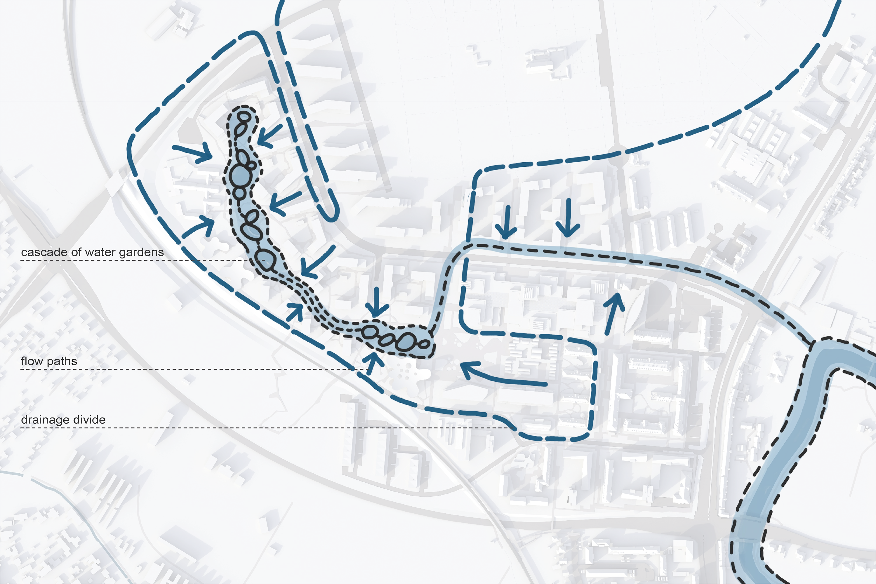
The watershed system and the continuous drainage network of canals, reservoirs, and bio-ponds create a closed water cycle, technical infrastructure, and micro climate. Rainwater is retained, filtered, and reused through the canal system.
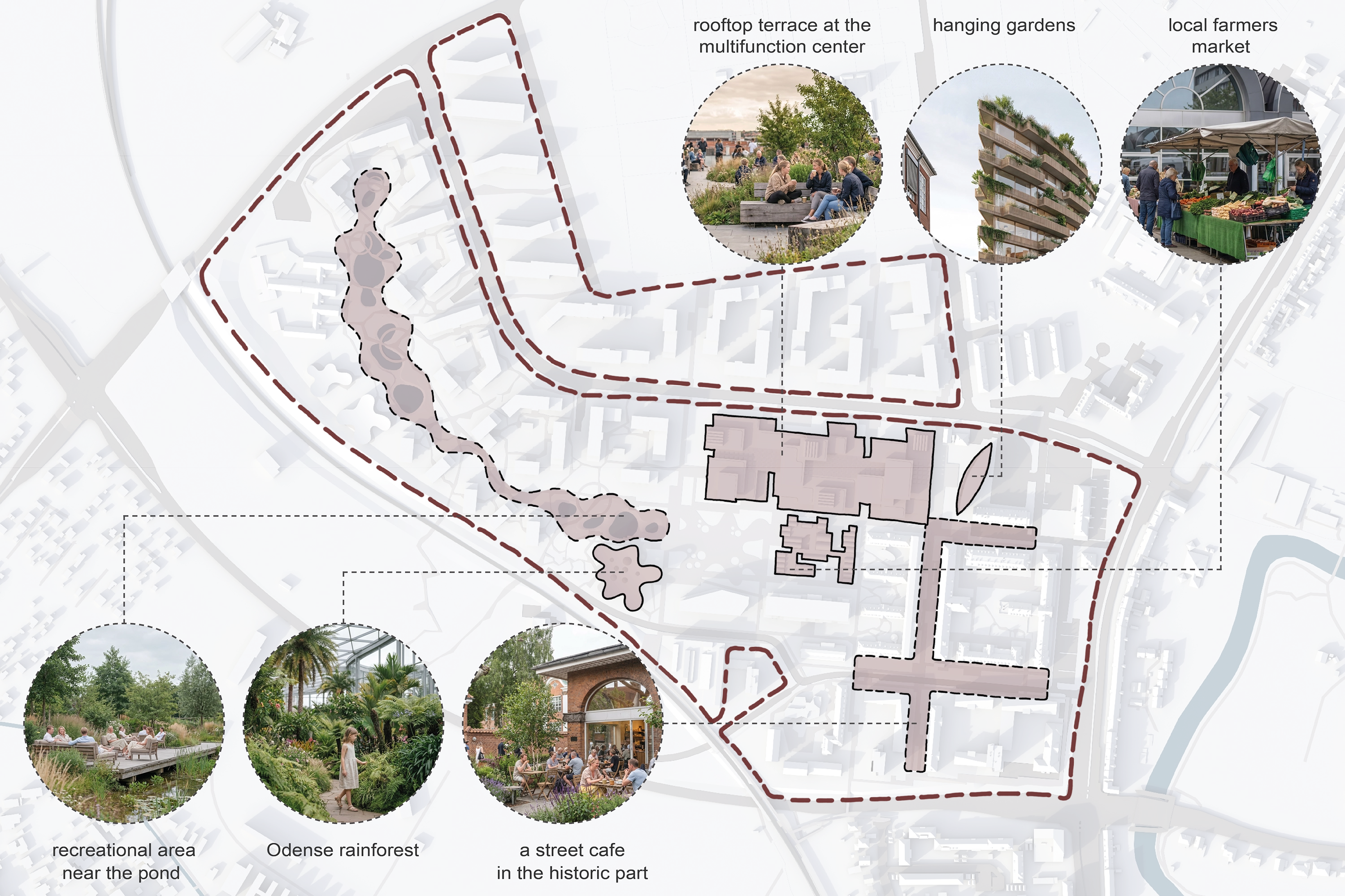
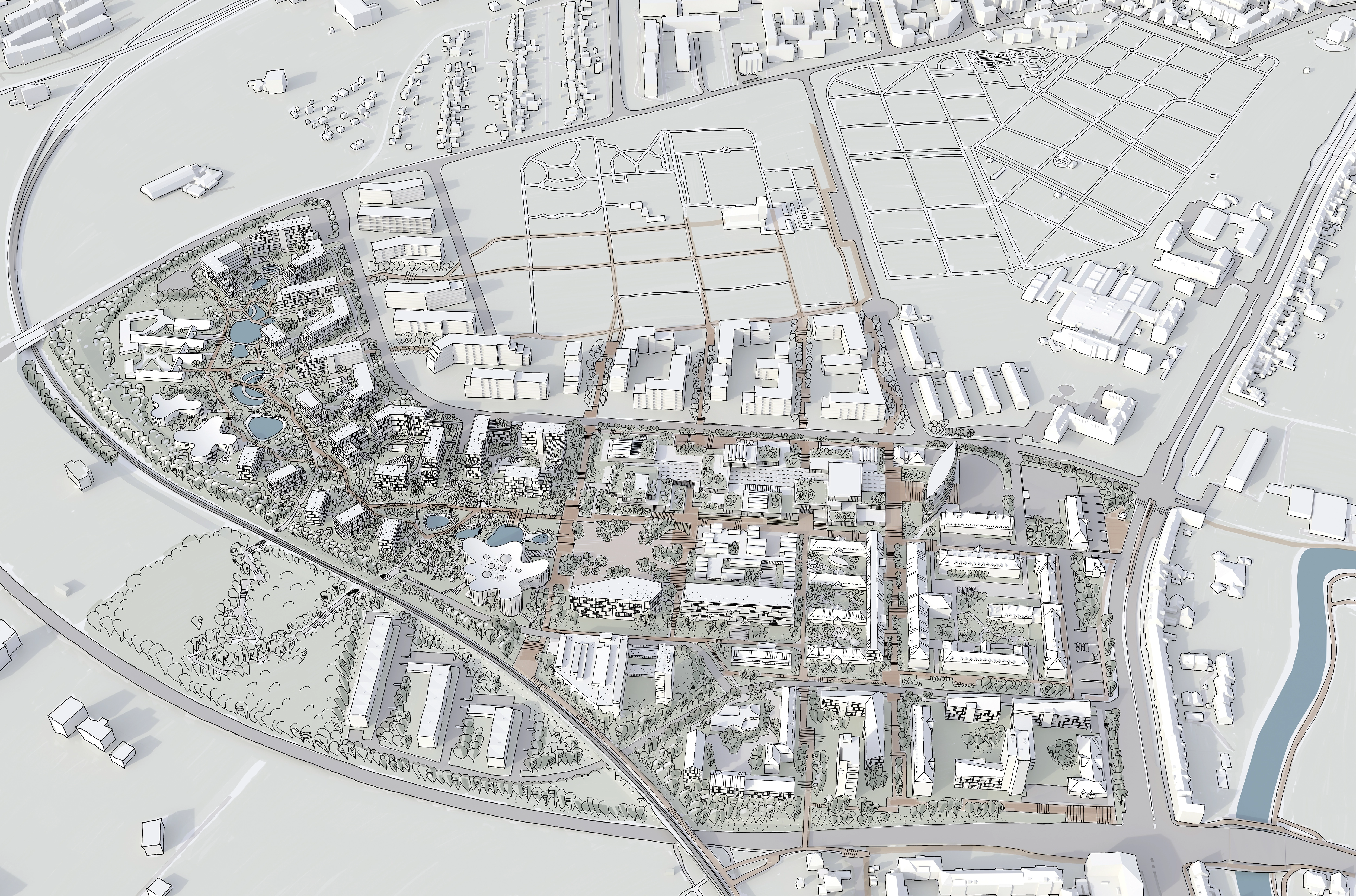
The diagram illustrates how public functions are distributed across the new district, forming a continuous network of everyday urban life. It connects all parts of the district into a coherent system that encourages movement, social interaction, and local activity. The structure strengthens the relationship between the historic areas and the surrounding neighborhoods, while enhancing the district’s recreational and ecological qualities.
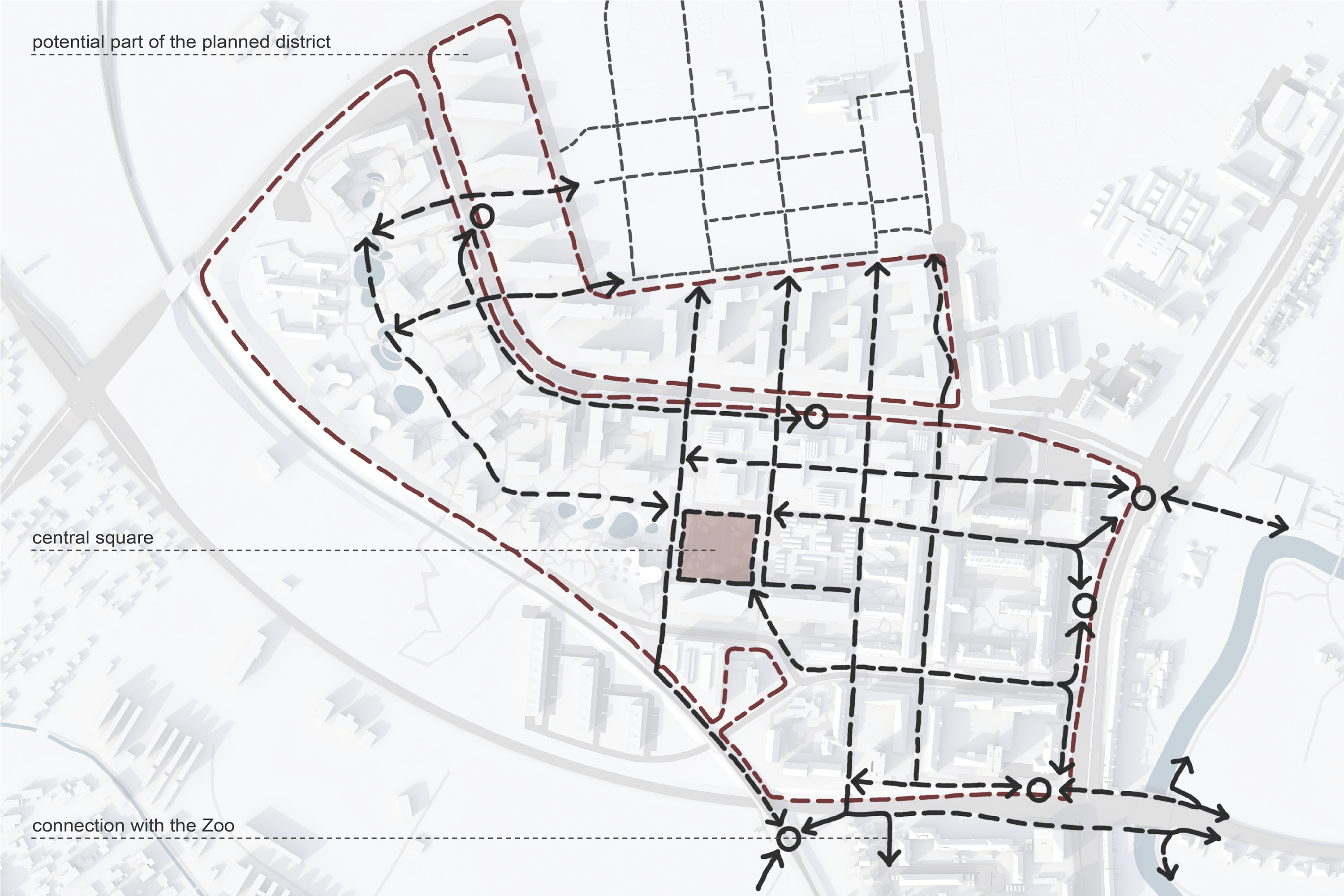
Pedestrian connections in the new district ensure continuity, integration, and ecological permeability between the cemetery recreational area and surrounding neighborhoods. The district is accessible to both people and animals through eco-corridors. Efficient routes and access to public transport are provided, while new pedestrian links connect to the cemetery’s existing paths. The area between the cemetery and the new district is considered part of the planned district.